Showing 10 of 267 records (filtered)
Applied filters: INSPIRE Theme: EL: Elevation × Clear all filters
Page 1 of 27. next last »
Preview
Title
Abstract
Country
INSPIRE Theme
Publication Date
Responsible Party
Topic Categories
Keywords
Access Constraints
Actions
🖼️
Amendments to the Regulation Plan "Slatinska Bare" City of Cazin By the decision of the Municipal Council of the Municipality of Cazin adopted at the session held on May 31, … Bosnia and Herzegovina July 14, 2023 City of Cazin otherRestrictions
🖼️
Amendments to the Regulatory Plan "Wood Industry", Ključ By the decision of the Municipal Council of the Municipality of Ključ adopted at the session held on September 2, … Bosnia and Herzegovina March 3, 2025 Municipality of Ključ otherRestrictions
🖼️
Amendments to the Zoning Plan of the business zone "Ratkovac" City of Cazin By the decision of the Municipal Council of the Municipality of Cazin adopted at the session held on May 31, … Bosnia and Herzegovina July 14, 2023 City of Cazin otherRestrictions
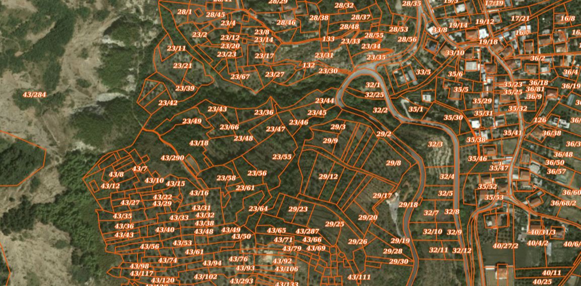
Graphic overview for Cadastral Parcels (ALBSCAD)
Cadastral Parcels (ALBSCAD) Cadastral Zones or Cadastral Blocks which have been worked on in the Multifunctional system by the Local Directorates of the … Albania March 28, 2025 State Cadastre Agency (SCA) copyright
Graphic overview for Cadastre of approved exploitation fields
Cadastre of approved exploitation fields FMERI maintains a cadastre of approved exploitation fields of mineral raw materials in the territory of the Federation of BiH, … Bosnia and Herzegovina None Federal Ministry of Energy, Mining and Industry otherRestrictions
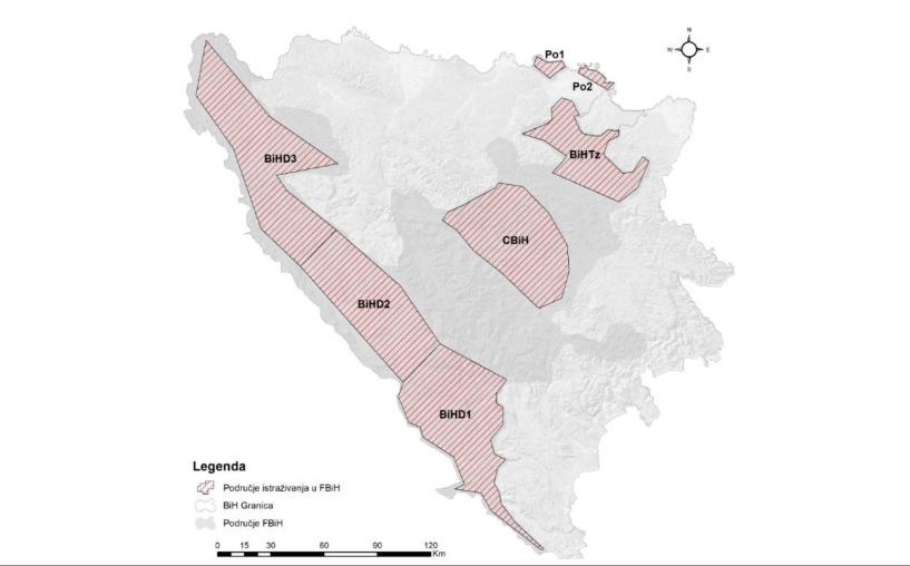
Graphic overview for Cadastre of approved research areas
Cadastre of approved research areas FMERI maintains a cadastre of approved exploration areas for mineral raw materials in the Federation of BiH, based on approvals … Bosnia and Herzegovina None Federal Ministry of Energy, Mining and Industry otherRestrictions
Graphic overview for Digital Elevation Model of the Republic of Macedonia - raster (DEM), dataset metadata
Digital Elevation Model of the Republic of Macedonia - raster (DEM), dataset metadata Digital Elevation Model (DEM) with a resolution of 20x20m for the entire territory of the Republic of Macedonia. North Macedonia Jan. 1, 2010 Agency for Real Estate Cadastre otherRestrictions
Graphic overview for Digital Elevation Model of the terrain 2009, 5m grid, entire territory of RSM, metadata for the dataset
Digital Elevation Model of the terrain 2009, 5m grid, entire territory of RSM, metadata for the dataset Digital terrain elevation model developed in 2009 for the entire territory of the Republic of Macedonia with a 5m grid North Macedonia Jan. 1, 2009 Ministry of Agriculture, Forestry and Water Management otherRestrictions
Graphic overview for Digital Elevation Model of the terrain of the Republic of Macedonia - isohypses, metadata of the dataset - INSPIRE
Digital Elevation Model of the terrain of the Republic of Macedonia - isohypses, metadata of the dataset - INSPIRE Elevation model of the terrain of the Republic of Macedonia represented through continuous lines with a main contour at 50m. North Macedonia None Agency for Real Estate Cadastre otherRestrictions
Graphic overview for Digital Elevation Model of the Terrain of the Republic of Macedonia - vector (DTM), dataset metadata
Digital Elevation Model of the Terrain of the Republic of Macedonia - vector (DTM), dataset metadata A regular arrangement of elevation points in vector form at a distance of 20m covering the entire territory of the … North Macedonia Jan. 1, 2010 Agency for Real Estate Cadastre otherRestrictions
Showing 10 of 267 records (filtered)
Page 1 of 27. next last »