Showing 10 of 50 records (filtered)
Applied filters: Keywords: Cover × Clear all filters
« first previous Page 3 of 5. next last »
Preview
Title
Abstract
Country
INSPIRE Theme
Publication Date
Responsible Party
Topic Categories
Keywords
Access Constraints
Actions
Graphic overview for LIDAR 3D laser scanning of the terrain (phase 1) - point cloud (x,y,z)
LIDAR 3D laser scanning of the terrain (phase 1) - point cloud (x,y,z) point cloud is a large collection of 3D points, which have defined x, y and z coordinates but can also … North Macedonia Not specified Dec. 1, 2020 Agency for Real Estate Cadastre otherRestrictions
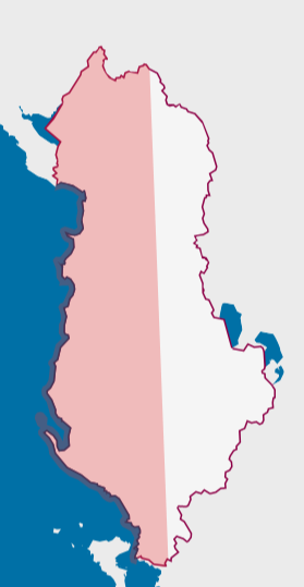
Graphic overview for Orthoimagery Coverage 2026
Orthoimagery Coverage 2026 Information on the coverage area and technical specifications of orthoimagery for the year 2026. The data are in accordance with … Albania July 28, 2026 State Authority for Geospatial Information (ASIG) copyright
Graphic overview for Overview topographic map from the Military Geographical Institute Belgrade (VGI) at a scale of 1:500000 (PTK 500) - Skopje 56, metadata for the dataset
Overview topographic map from the Military Geographical Institute Belgrade (VGI) at a scale of 1:500000 (PTK 500) - Skopje 56, metadata for the dataset The overview topographic map at a scale of 1:500,000 was produced by the VGI Belgrade in 1982. The map is … North Macedonia Not specified Jan. 1, 1982 Agency for Real Estate Cadastre otherRestrictions
Graphic overview for Study "Inventory of the state and updating of data on agricultural areas of the Sarajevo Canton"
Study "Inventory of the state and updating of data on agricultural areas of the Sarajevo Canton" The subject of the Study is to determine the current state of land cover in the Sarajevo Canton by land … Bosnia and Herzegovina Feb. 1, 2024 Ministry of Municipal Economy, Infrastructure, Spatial Planning, Construction and Environmental Protection of Sarajevo Canton otherRestrictions
Graphic overview for Topographic map from the Military Geographical Institute Belgrade (VGI) at a scale of 1:100000 (TK100), metadata for the dataset
Topographic map from the Military Geographical Institute Belgrade (VGI) at a scale of 1:100000 (TK100), metadata for the dataset The topographic map at a scale of 1:100,000 was produced by the VGI Belgrade in the period 1970-1987. The territory … North Macedonia Not specified Jan. 1, 1970 Agency for Real Estate Cadastre otherRestrictions
Graphic overview for Topographic map from the Military Geographical Institute Belgrade (VGI) at a scale of 1:200000 (TK200), metadata for the dataset
Topographic map from the Military Geographical Institute Belgrade (VGI) at a scale of 1:200000 (TK200), metadata for the dataset The topographic map at a scale of 1:200,000 was produced by the VGI Belgrade in 1973. The territory of the … North Macedonia Not specified Jan. 1, 1973 Agency for Real Estate Cadastre otherRestrictions
Graphic overview for Topographic map from the Military Geographical Institute Belgrade (VGI) at a scale of 1:50000 (TK50), metadata for the dataset
Topographic map from the Military Geographical Institute Belgrade (VGI) at a scale of 1:50000 (TK50), metadata for the dataset The topographic map at a scale of 1:50000 was produced by the VGI Belgrade in 1966. The territory of the … North Macedonia Not specified Jan. 1, 1966 Agency for Real Estate Cadastre otherRestrictions
Graphic overview for Topographic map of the Republic of Macedonia at a scale of 1:100000, metadata for the dataset
Topographic map of the Republic of Macedonia at a scale of 1:100000, metadata for the dataset The topographic map at a scale of 1:100,000 in raster format was produced in the period from July 2015 to … North Macedonia Not specified Jan. 1, 2018 Agency for Real Estate Cadastre otherRestrictions
Graphic overview for Topographic map of the Republic of North Macedonia (TK 200-2004) - raster, dataset metadata
Topographic map of the Republic of North Macedonia (TK 200-2004) - raster, dataset metadata The topographic maps at a scale of 1:200000 (TK 200-2004) were produced in the period from January 2017 to June … North Macedonia Not specified Jan. 1, 2018 Agency for Real Estate Cadastre otherRestrictions
Graphic overview for Topographic map of the Republic of North Macedonia at a scale of 1:25000-raster, metadata for the dataset
Topographic map of the Republic of North Macedonia at a scale of 1:25000-raster, metadata for the dataset The topographic map at a scale of 1:25000 was produced in the period from 2004 to 2011 and is in … North Macedonia Not specified Jan. 1, 2012 Agency for Real Estate Cadastre otherRestrictions
Showing 10 of 50 records (filtered)
« first previous Page 3 of 5. next last »