Showing 9 of 19 records (filtered)
Applied filters: Keywords: Grid × Clear all filters
« first previous Page 2 of 2.
Preview
Title
Abstract
Country
INSPIRE Theme
Publication Date
Responsible Party
Topic Categories
Keywords
Access Constraints
Actions
Graphic overview for Nomenclature of cadastral plan sheets, metadata for dataset
Nomenclature of cadastral plan sheets, metadata for dataset Nomenclature of sheets of cadastral plans for scales 1:500, 1:1000, 1:2500, 1:5000, 1:10000. Nomenclature of sheets of cadastral plans is … North Macedonia Dec. 22, 2018 Agency for Real Estate Cadastre otherRestrictions
Graphic overview for Nomenclature of sheets in the cartographic database for TK25,TK50,TK100 and TK200
Nomenclature of sheets in the cartographic database for TK25,TK50,TK100 and TK200 Nomenclature of map sheets is the division of the earth's surface into sheets according to certain rules and their numbering … North Macedonia April 1, 2004 Agency for Real Estate Cadastre otherRestrictions
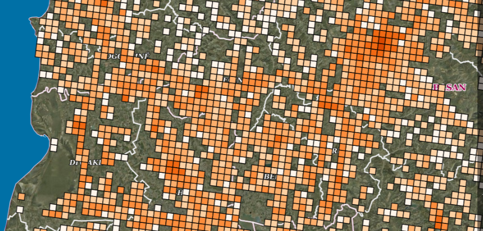
Graphic overview for Statistical Units (2023), Grid 1 km2 Census (INSTAT)
Statistical Units (2023), Grid 1 km2 Census (INSTAT) The 2023 Census data on the population distribution of the Republic of Albania at the Grid 1 Km² level are … Albania May 14, 2026 Institute of Statistics (INSTAT) copyright
🖼️
Statistical Units (INSTAT 2023) Statistical Units (INSTAT). The data are in accordance with the State Standard for Technical Specifications of Geospatial Information in Albania. … Albania Not specified May 14, 2026 Institute of Statistics (INSTAT) Not specified copyright
🖼️
Statistical Units (INSTAT) Statistical Units (INSTAT). The data does not conform to the State Standard for Technical Specifications of Geospatial Information in Albania. … Albania Not specified Jan. 1, 2014 Institute of Statistics (INSTAT) Not specified copyright
Graphic overview for Topographic map from the Military Geographical Institute Belgrade (VGI) at a scale of 1:25000 (TK25), metadata for the dataset
Topographic map from the Military Geographical Institute Belgrade (VGI) at a scale of 1:25000 (TK25), metadata for the dataset The topographic map in scale 1: 25000 was produced by VGI Belgrade in 1978. The territory of the Republic of … North Macedonia Not specified Jan. 1, 1978 Agency for Real Estate Cadastre otherRestrictions
Graphic overview for Topographic map of the Republic of North Macedonia (TK 200-2004) - raster, dataset metadata
Topographic map of the Republic of North Macedonia (TK 200-2004) - raster, dataset metadata The topographic maps at a scale of 1:200000 (TK 200-2004) were produced in the period from January 2017 to June … North Macedonia Not specified Jan. 1, 2018 Agency for Real Estate Cadastre otherRestrictions
Graphic overview for Topographic map of the Republic of North Macedonia at a scale of 1:25000-raster, metadata for the dataset
Topographic map of the Republic of North Macedonia at a scale of 1:25000-raster, metadata for the dataset The topographic map at a scale of 1:25000 was produced in the period from 2004 to 2011 and is in … North Macedonia Not specified Jan. 1, 2012 Agency for Real Estate Cadastre otherRestrictions
Graphic overview for Topographic map of the Republic of North Macedonia at a scale of 1:50000 (TK 50 - 2017) - raster, metadata for the dataset
Topographic map of the Republic of North Macedonia at a scale of 1:50000 (TK 50 - 2017) - raster, metadata for the dataset The contents of the "Topographic Map of the Republic of North Macedonia" at a scale of 1: 50000 (TK 50 … North Macedonia Not specified Aug. 1, 2024 Agency for Real Estate Cadastre otherRestrictions
Showing 9 of 19 records (filtered)
« first previous Page 2 of 2.