Showing 5 of 5 records (filtered)
Applied filters: Keywords: RGB × Clear all filters
Preview
Title
Abstract
Country
INSPIRE Theme
Publication Date
Responsible Party
Topic Categories
Keywords
Access Constraints
Actions
Graphic overview for Color orthophoto 2009 (RGB), over the entire territory of RSM, metadata for the dataset
Color orthophoto 2009 (RGB), over the entire territory of RSM, metadata for the dataset Color orthophoto from 2009, for the entire territory of the country. RGB (Red, green, blue) with 0.5m pixel. Owned by … North Macedonia Not specified July 15, 2009 Ministry of Agriculture, Forestry and Water Management otherRestrictions
Graphic overview for Color orthophoto 2017 (RGB), across the entire territory of RSM, metadata on the download service, ATOM - INSPIRE
Color orthophoto 2017 (RGB), across the entire territory of RSM, metadata on the download service, ATOM - INSPIRE Predefined service for downloading color orthophotos 2017 (RGB), for the entire territory of the Republic of Macedonia. Created in accordance … North Macedonia Not specified Aug. 15, 2017 Agency for Real Estate Cadastre Not specified otherRestrictions
Graphic overview for Color orthophoto 2017 (RGB), over the entire territory of RSM, dataset metadata
Color orthophoto 2017 (RGB), over the entire territory of RSM, dataset metadata Color orthophoto from 2017, for the entire territory of the country. RGB (Red, green, blue). 0.3m pixel. Owned by the … North Macedonia Not specified Aug. 15, 2017 Ministry of Agriculture, Forestry and Water Management otherRestrictions
Graphic overview for LIDAR 3D laser scanning of the terrain (phase 1) - point cloud (x,y,z)
LIDAR 3D laser scanning of the terrain (phase 1) - point cloud (x,y,z) point cloud is a large collection of 3D points, which have defined x, y and z coordinates but can also … North Macedonia Not specified Dec. 1, 2020 Agency for Real Estate Cadastre otherRestrictions
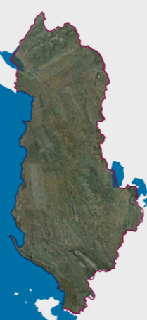
Graphic overview for Orthophoto 2015 (20cm)
Orthophoto 2015 (20cm) RGB orthophoto period 2015-2017 with a resolution of 20 cm per pixel covering the territory of the Republic of Albania. … Albania Dec. 1, 2017 State Authority for Geospatial Information copyright
Showing 5 of 5 records (filtered)