Showing 10 of 56 records (filtered)
Applied filters: Keywords: network × Clear all filters
Page 1 of 6. next last »
Preview
Title
Abstract
Country
INSPIRE Theme
Publication Date
Responsible Party
Topic Categories
Keywords
Access Constraints
Actions
Graphic overview for Cadastral plans of the Republic of North Macedonia - archival originals at a scale of 1:1000 - raster, metadata for the dataset
Cadastral plans of the Republic of North Macedonia - archival originals at a scale of 1:1000 - raster, metadata for the dataset The archival originals of the cadastral plans at a scale of 1:1000 were prepared for cadastral municipalities under the jurisdiction … North Macedonia Not specified Jan. 1, 2000 Agency for Real Estate Cadastre otherRestrictions
Graphic overview for Cadastral plans of the Republic of North Macedonia - archival originals at a scale of 1:10000 - raster, metadata for the dataset
Cadastral plans of the Republic of North Macedonia - archival originals at a scale of 1:10000 - raster, metadata for the dataset The archival originals of the cadastral plans at a scale of 1:10000 were prepared for some of the cadastral municipalities … North Macedonia Not specified Jan. 1, 2000 Agency for Real Estate Cadastre otherRestrictions
Graphic overview for Cadastral plans of the Republic of North Macedonia - archival originals at a scale of 1:500 - raster, metadata for the dataset
Cadastral plans of the Republic of North Macedonia - archival originals at a scale of 1:500 - raster, metadata for the dataset The archival originals of the cadastral plans in scale 1:500 were prepared for urban areas. They were prepared for some … North Macedonia Not specified Jan. 1, 2000 Agency for Real Estate Cadastre otherRestrictions
Graphic overview for Digital Elevation Model of the terrain 2009, 5m grid, entire territory of RSM, metadata for the dataset
Digital Elevation Model of the terrain 2009, 5m grid, entire territory of RSM, metadata for the dataset Digital terrain elevation model developed in 2009 for the entire territory of the Republic of Macedonia with a 5m grid North Macedonia Jan. 1, 2009 Ministry of Agriculture, Forestry and Water Management otherRestrictions
Graphic overview for Digital Elevation Model of the terrain 2017, 5m grid, entire territory of RSM, metadata for dataset
Digital Elevation Model of the terrain 2017, 5m grid, entire territory of RSM, metadata for dataset Digital Elevation Model of the terrain 2017, 5m grid, entire territory of RSM, metadata for dataset North Macedonia Not specified Aug. 15, 2017 Ministry of Agriculture, Forestry and Water Management otherRestrictions
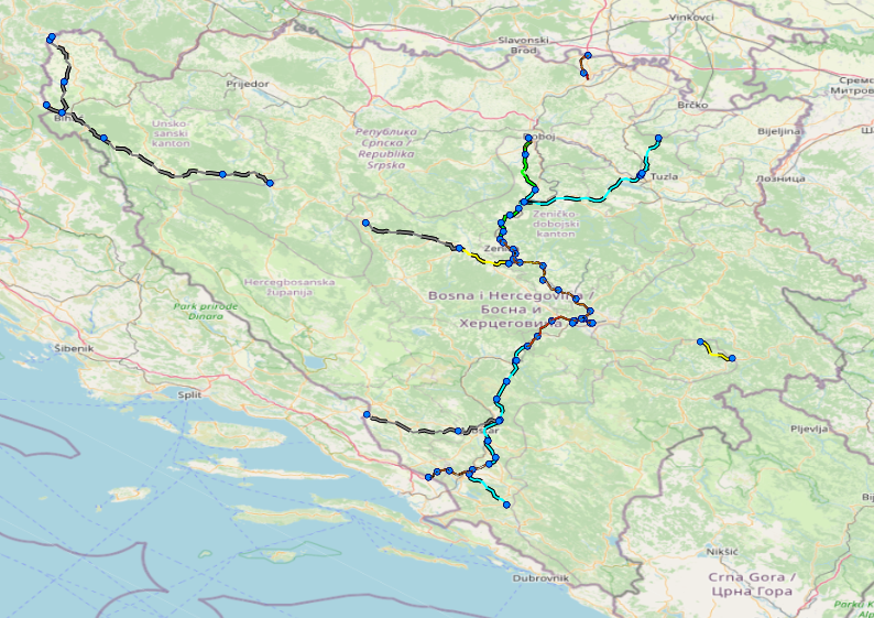
Graphic overview for Facilities under the jurisdiction of the Highway Federation of Bosnia and Herzegovina
Facilities under the jurisdiction of the Highway Federation of Bosnia and Herzegovina Tollbooths, rest areas, Grnični prešel, COKP, permanent facilities (bridge, tunnel, viaduct, ramp, overpass, underpass and culverts) and auxiliary facilities Bosnia and Herzegovina None JP Highways of the Federation of BiH doo Mostar otherRestrictions
Graphic overview for General geographic map from the Military Geographical Institute Belgrade (VGI) at a scale of 1:1000000- Skopje K34, metadata for the dataset
General geographic map from the Military Geographical Institute Belgrade (VGI) at a scale of 1:1000000- Skopje K34, metadata for the dataset The general geographic map at a scale of 1:1000000 was produced by the VGI Belgrade and supplemented in 1972. The … North Macedonia Not specified None Agency for Real Estate Cadastre otherRestrictions
Graphic overview for Gravimetric network of the Republic of North Macedonia
Gravimetric network of the Republic of North Macedonia The gravimetric network is divided into: Absolute gravimetric network (zero order) and relative gravimetric network (first order). The absolute gravimetric … North Macedonia Not specified Feb. 16, 2021 Agency for Real Estate Cadastre otherRestrictions
Graphic overview for High-precision leveling network in the Republic of North Macedonia, dataset metadata
High-precision leveling network in the Republic of North Macedonia, dataset metadata The high-precision leveling network is a unique network that covers the entire territory of the Republic of North Macedonia and … North Macedonia Not specified Jan. 1, 1957 Agency for Real Estate Cadastre otherRestrictions
Graphic overview for Hydrography of the Republic of Macedonia TK250, metadata of the download service, ATOM - INSPIRE
Hydrography of the Republic of Macedonia TK250, metadata of the download service, ATOM - INSPIRE Predefined set for downloading the dataset - hydrography of the Republic of Macedonia at a scale of 1:250000, developed according … North Macedonia Not specified May 4, 2017 Agency for Real Estate Cadastre Not specified otherRestrictions
Showing 10 of 56 records (filtered)
Page 1 of 6. next last »